Posts Tagged ‘History’

A Last Look At St. Simons

September 24, 2008
Tabby (oyster shells, lime, ash, sand and water) was used in construction during the colonial period.

Tabby (oyster shells, lime, ash, sand and water) was used in construction during the colonial period.

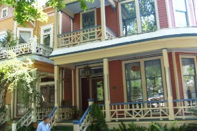
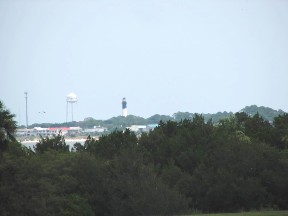
Betsy and I thoroughly enjoyed our visit to St. Simons Island in June of this year.  The highlights of our time on the island were the Lighthouse, Epworth By The Sea, Fort Frederica, and Christ Church, Frederica.  But there were many other interesting things to see on the island.

I’ve always been fascinated by ships and the sea.  In 1961 I was in Boston and had the opportunity to tour U.S.S. Constitution, the famous Old Ironsides.  I must admit that it was awesome to be able to board that piece of history.

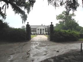
One of the places we visited on St. Simons was Gascoigne’s Bluff.  The bluff has been an Indian settlement before the English arrived, the site of the most beautiful plantation on the island, and the headquarters of a Spanish invasion in 1742.  But what was most interesting to me was the fact that the timbers that were used to construct Old Ironsides in 1794 came from trees growing on Gascoigne’s Bluff.  In 1874 timbers from this bluff were used in the construction of the Brooklyn Bridge.

We also visited two slave cabins on what was once the Hamilton Plantation.

We also visited the site of the Battle of Bloody Marsh.  This was the place where the British ambushed the Spanish in 1742 and won a decisive victory which resulted in the Spanish leaving St. Simons Island and returning to St. Augustine.

To see more of St. Simons Island click HERE.

Christ Church, Frederica

September 22, 2008
Christ Church, Frederica, St. Simons Island.  June 25, 2008.

Christ Church, Frederica, St. Simons Island. June 25, 2008.

While Betsy and I were visiting St. Simons Island in Georgia, we stopped at Christ Church, Frederica.  Christ Church is an Episcopal Church built on the site of the first Episcopal church on the island.

Actually, the history of worship on the site goes back even further.  In March, 1736, Charles Wesley held worship services for the new settlers at Frederica.  In 1737 John Wesley established a church for the people of Frederica and the other settlement on the island, Fort St. Simon.  When John Wesley left St. Simons he was replaced by George Whitefield.  All three men held services on the site of the present church.

The building of a church structure was delayed by the Revolutionary War, and it wasn’t until 1810 that the construction of a church building on the site began.  The building was completed in 1820 and used until the Civil War.

Returning at the end of the Civil War, residents of St. Simons found Union troops had destroyed much of the church.  Windows had been broken, pews smashed and burned, the roof was heavily damaged and both the altar and the organ had been destroyed.

The congregation met in homes until 1884, when Anson Green Phelps Dodge rebuilt the church as a memorial to his first wife.  It is this church which we visited.  The church building is cruciform in design, with a trussed Gothic roof.  The building contains beautiful stained glass windows depicting incidents in the life of Christ and the early history of the church on St. Simons.

To see more of our visit to Christ Church click HERE.

Fort Frederica

September 19, 2008
Cannon along the river at Fort Frederica.  June 25, 2008.

Cannon along the river at Fort Frederica. June 25, 2008.

After visiting Epworth By The Sea on St. Simons Island, Betsy and I drove  to Fort Frederica National Monument, also on the island.

The town of Frederica was founded by General James Oglethorpe in 1736, three years after the founding of the Georgia colony at Savannah.  In the 1730s Great Britain was engaged in a struggle with Spain for land in what is now the southeastern United States.  Both countries claimed the land between St. Augustine (held by the Spanish) and Charleston (held by the British).  The British founded Georgia to serve as a buffer along their southern frontier.

In 1736 Oglethorpe landed on St. Simons Island with 44 men (mostly skilled workers) and 72 women and children.  Their first task was to build a fort to command the river, but they then built the town of Frederica.  By the 1740s Frederica was a tsubstantial village of about 500 people which would easily fit in the English midlands.

War broke out between Spain and Great Britain in 1739.  In 1742 the Spanish invaded St. Simons and got to within sight of Frederica, but were beaten back.  Later that same day the British won a decisive victory against the Spanish at Bloody Marsh and the Spanish left the island within a week.

Peace brought about the fairly rapid decline of Frederica as soldiers were no longer stationed in the  town.  The town survived a fire in 1758, but fell into ruin soon thereafter.

To see more of our trip to Frederica click HERE.

Epworth By The Sea

September 17, 2008
George at Lovely Lane Chapel, Epworth By The Sea, Georgia.  June 25, 2008.

George at Lovely Lane Chapel, Epworth By The Sea, Georgia. June 25, 2008.

When we were planning our anniversary trip Betsy wanted us to go to St. Simons Island, since she had been there previously and wanted to show me around.  In addition to St. Simons Lighthouse, she especially wanted me to see Epworth By The Sea, the Methodist Conference Center on the island.  The purpose of Epworth is to provide a Christian place for worship, study and fellowship.

The ties between Methodism and St. Simons are strong.  John and Charles Wesley, founders of the Methodist Church, visited St. Simons Island and Fort Frederica in March of 1736.

One of the features of Epworth By The Sea is Lovely Lane Chapel.  The chapel is a church built in 1880 as St. James Union Church and is now the oldest church building on St. Simons.  When the Methodist Church purchased the property containing the church in 1949, the church was renamed Lovely Lane Chapel after the site of the 1784 founding conference of American Methodism in Baltimore, Maryland.

Epworth By The Sea is a beautiful place and I understand why Betsy wanted to share it with me.  To see more of our visit to Epworth By The Sea click HERE.

St. Simons Light

September 14, 2008
George at the walkway leading to the beach at St. Simons Lighthouse.  June 24, 2008.

George at the walkway leading to the beach at St. Simons Lighthouse. June 24, 2008.

On our anniversay trip, after exploring Savannah for much of the day, we headed south to St. Simons Island.  We reached St. Simons in the afternoon and went to the lighthouse, which was built in 1872.  The lighthouse and keeper’s house are the oldest surviving brick structures in Glynn County, Georgia.  The lighthouse is 104 feet tall and is open to the public, but we passed on the opportunity to walk up the 129 steps to the top!

The present lighthouse is the second on the site.  The original lighthouse was built in 1807 and lasted until 1862, when it was blown up by retreating Confederates when they abandoned St. Simons.

We visited the beach and park near the lighthouse.  The park contained several huge live oak trees which we paused to admire.

After driving around St. Simons for a little bit, we decided to try one of the local restaurants for dinner.  To see more of our visit to St. Simons Lighthouse, click HERE.

Walking Through Savannah Squares

September 9, 2008
The Hamilton-Turner Inn on Lafayette Square, Savannah.  June 24, 2008.

The Hamilton-Turner Inn on Lafayette Square, Savannah. June 24, 2008.

After Betsy and I left the Cathedral of St. John the Baptist in Savannah, we had a little time to walk around a couple of the squares nearby.

The Cathedral is on Lafayette Square, which is named for the Marquis de Lafayette, the Frenchman who served as George Washington’s aide de camp during the Revolution.  Until 1846 the Savannah City Jail was located beside this square.  In 1983 the National Society of the Colonial Dames of America installed a fountain in the center of this square commemorating the 250th anniversary of the founding of Georgia.

The Hamilton-Turner Inn, built in 1873, faces Lafayette Square, as does the home of Georgia’s prize-winning 20th century author Flannery O’Connor.

We then walked along Macon Street, which contains some beautiful row houses, to Troup Square.

Troup Square is named for George Michael Troup, a native of the region who served as a Congressman, a Senator, and the Governor of Georgia.  Troup Square is smaller than most of the other squares and is made even more unique by its Victorian armillary.

The Unitarian Universalist Church (built in 1851) is on this square.  The organist and choir director of this church, James Pierpont, wrote the song “Jingle Bells”.

To see more of our walk through these Savannah squares click HERE.

Savannah Tour

August 31, 2008
Victorian Row Houses in Savannah, Georgia.  June 24, 2008.

Victorian Row Houses in Savannah, Georgia. June 24, 2008.

The day after visiting Fort Pulaski and Tybee Island, Betsy and I went to downtown Savannah to tour the historic district.

Georgia was the last of the English colonies to be founded in North America.  James Edward Oglethorpe is considered the founder of Georgia, although he was only one of 21 persons named as trustees of the new colony.  An interesting provision of the original charter was that rum, lawyers and slavery were forbidden!

England had several reasons for founding Georgia.  Oglethorpe was personally interested in providing relief to the debtors of England and in helping the English poor and  unemployed.  The English crown wanted to remove the poor so England would not have to support them.  Another interest of the crown was to provide a buffer to protect South Carolina from Spaniards in Florida.

Oglethorpe and 120 other settlers arrived in what is now Savannah in February, 1733.  Oglethorpe soon became friends with a local Indian chief, Tomochichi.  Oglethorpe and Tomochichi pledged mutual goodwill and the Yamacraw chief granted the new arrivals permission to settle Savannah on its bluff above the river.  As a result the town flourished without warfare and the accompanying hardship the burdened many of England’s early colonies.

Savannah is known as America’s first planned city.  Oglethorpe laid the city out in a series of grids that allowed for wide open streets dotted with shady public squares and parks that served as town meeting places and centers of business.  Savannah had 24 original squares and 21 of them are still in existence.

I must admit that we didn’t enjoy our tour of Savannah as much as we enjoyed our tour of Charleston, but we did get a good overview of the historic district and are now ready to go back and take a walking tour!

To see more of our tour click HERE.

Tybee Island

August 29, 2008
Tybee Island and lighthouse from the walls of Fort Pulaski.  June 23, 2008.

Tybee Island and lighthouse from the walls of Fort Pulaski. June 23, 2008.

I mentioned a couple of days ago that Betsy and I visited Fort Pulaski while on our anniversary trip in June.  From the walls of Fort Pulaski we could see Tybee Island and its lighthouse, and since Betsy is as interested in lighthouses as I am in Robert E. Lee, we had to go over to Tybee and visit the lighthouse.

Tybee Island and Fort Pulaski (on Cockspur Island) are closely connected.  In 1861 Confederates held both Tybee Island and Fort Pulaski.  But in November of that year the Union army and navy captured Hilton Head Island (South Carolina) on Port Royal Sound.  Hilton Head is only about 15 miles north of Fort Pulaski, and using this as a base the Union was able to mount operations against Fort Pulaski and the entire South Atlantic coast.

Since the Confederate troops on Tybee Island were in danger of being cut off by the Union navy, Robert E. Lee ordered that they be withdrawn.  He did this because he felt Fort Pulaski was impregnable. but by doing so he unknowingly gave the Union the only site from which Fort Pulaski could be taken.

The Union army under Engineer Captain Quincy A. Gillmore quickly began to build siege batteries on the only firm ground in the area — the northwestern shore of Tybee Island.  Although this site was over a mile from Fort Pulaski, Gilmore had ten of the new rifled cannon available and he was certain that these cannon could breach the brick walls of Fort Pulaski and force its surrender.

On April 10, 1862, after the Confederates refused Gillmore’s formal demand for surrender, the Union forces opened fire on the fort.  The rest, as they say, is history.

Fort Pulaski

August 26, 2008
The flag flying at Fort Pulaski.  June 23, 2008.

The flag flying at Fort Pulaski. June 23, 2008.

In the early 1800s the United States constructed a third system of forts to protect the East and Gulf coasts from invasion.  Most of those forts still exist.

The fort constructed to protect Savannah, Georgia, was named Fort Pulaski in honor of the Polish Count Casimir Pulaski, who lost his life fighting against the British at Savannah during the Revolutionary War.

Fort Pulaski was designed to be one of the most modern fortifications ever built.  Many considered the fort’s 7½-foot solid brick walls backed with massive masonry piers unbreachable.  Construction of the fort started in 1829 and required $1 million dollars (that was real money back then!), 25 million bricks, and 18 years of work to finish.

Unfortunately for the designers of the fort technology did not stand still after the fort was complete.  The rifled cannon was perfected which had both greater accuracy and greater range.  Union rifled cannon a mile from the fort breached the walls and forced the Confederates to surrender after only 30 hours of bombardment.

Fort Pulaski was built on Cockspur Island which was extremely marshy.  Before the fort could be built, a dike and drainage system had to be designed and constructed.  The drainage system was designed by a young lieutenant of engineers — Robert E. Lee.  That explains why I was so interested in seeing the fort.

To see more of our visit to Fort Pulaski click HERE.

Boone Hall Plantation

July 25, 2008


The two major destinations on our anniversary trip were Charleston and Savannah. We did visit some waterfalls in north Georgia on our way south, but we arrived in the Charleston area on June 21.

Our first stop was Boone Hall Plantation in Mt. Pleasant, South Carolina. Boone Hall is one of America’s oldest working plantations. It was once known for cotton and pecans, but now produces peaches, strawberries, tomatoes and pumpkins, as well as other fruits and vegetables.

Boone Hall Plantation (including the first floor of the main house) has been open to the public since 1956. In the 1980s Boone Hall was featured in the mini-series North and South. Later it was used in the filming of Queen, the sequel to Alex Haley’s Roots.

Boone Hall Plantation got it’s start in 1681 when Theophilus Patey was granted 470 acres of land on Wampacheeoone Creek. John Boone, who arrived in South Carolina in 1672, married Patey’s daughter and the couple received the 470 acres as a wedding present. It was after the marriage that the plantation began to be known as Boone Hall. By 1811, when the Boone family sold the plantation it had increased to 1,452 acres.

Over the next 150 years Boone Hall was sold several times. Over those years the plantation increased in size to 4,039 acres and became one of the leading producers of pecans in the country. In 1955 the McRae family, who still own the plantation, purchased Boone Hall and opened it to the public.

One of the features of Boone Hall is an avenue of oaks — a three-quarter mile driveway leading to the main house lined with massive Spanish-moss draped Live Oaks. The Avenue of Oaks goes back to 1743. The present manor house was built in 1935 on the site of the original house.

To see more of our visit to Boone Hall, click HERE.