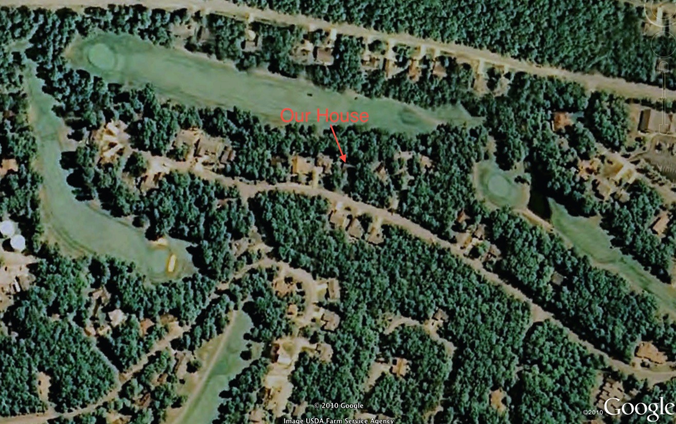
Google Earth image of our home. September, 2010.
(Note: All pictures may be enlarged by clicking on them once or twice.)
When Betsy and I travel, I use a geo-tracker to record the GPS coordinates of the pictures I take. I can then use Google Earth to map the location and get satellite or terrain views of the area.
Shortly after starting to use Google Earth, I entered our address and got the image above. I was able to find our house, but I wasn’t all that impressed.
When we got back from a trip to North Carolina a few weeks ago, I took some pictures in the yard before turning off the geo-tracker. While looking at the track of our trip on Google Earth, I zoomed in at the end of the track and found a new image of our house. I’ll have to admit I was impressed — and a little shocked.
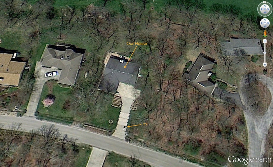
Google Earth image of our house. April 2013.
This new image makes it possible to see the house and the deck, including the table on the deck. The rose beds on each side of the driveway can be clearly seen, including the terracing we put in for the roses. I can see the round flowerbed around the yard lamppost, as well as the flower bed along the road.
The black dots on each side of the driveway are our container roses. There’s a black blob in the driveway near the road (indicated by ‘??’). I can’t be sure, but I think that might be me.
So who’s watching you?


