Archive for the ‘Travels’ Category

Could That Be Snow?

July 21, 2011

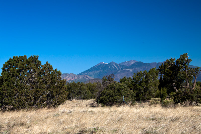
Could that white on the mountain be snow? Taken on I-40 near Flagstaff, Arizona. June 14, 2011.

As we drove toward Flagstaff, Arizona, on the morning of June 14, I noticed some white on a mountain top ahead of us.  Could that possibly be snow?  Two days earlier we had been driving across Oklahoma and Texas and the temperature outside had been 102°.  That white must be some kind of fence or building.

I kept my eye on the mountain as we drove, and quite frankly I kept changing my mind.  “That is definitely snow!”  “That can’t be snow.”  My Beautiful Bride, the snow expert in the family, was busy on her laptop, so I didn’t say anything.

After another twenty miles or so, I finally told Betsy that I thought there was snow on top of the mountain ahead of us.  Of course, she thought I was out of my mind, but when she looked up, she, too, thought it was snow.  So, as any blogger would do, I pulled to the side of the road to get the picture above.  So what do you think, snow or no snow?
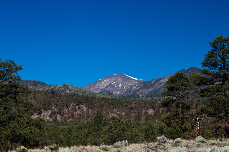
On Highway 89 east of Flagstaff. June 14, 2011.

When we got off the interstate and headed north, we got a little closer to the mountain.  That is definitely snow!
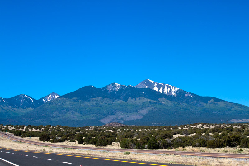
Looking back toward Flagstaff. June 14, 2011.

Betsy was definitely excited now.  When we were north of Flagstaff, we could look back at several peaks which still had a snow cover.  It was hard to believe we were looking at snow while driving across what the map said was desert.
Wide Open Spaces of Texas

July 14, 2011

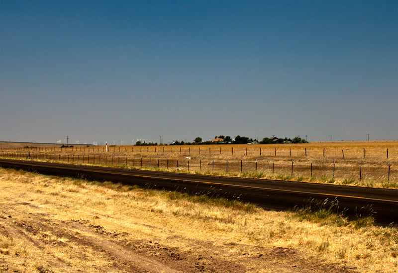
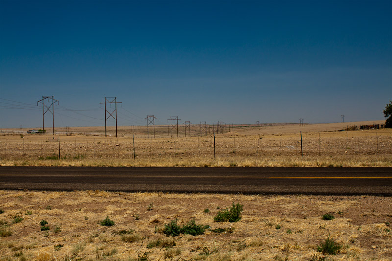
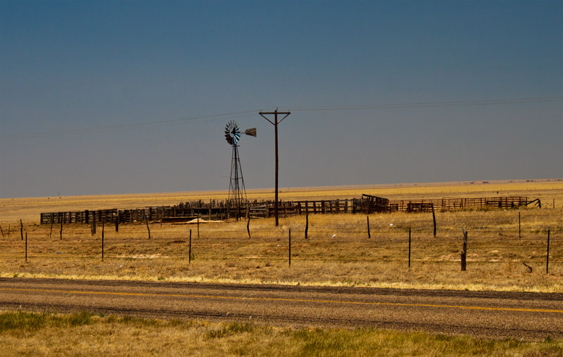
The Texas landscape west of Amarillo. June 12, 2011.

One of the first decisions Betsy and I had to make when planning our trip west was to fly or to drive.  There were advantages and disadvantages to each means of travel, but since our Prius, Mrs. P, is comfortable and gets 50+ MPG, we decided to drive so we could see more of our great country.

I must admit that I found the different landscapes we saw on our recent trip to be fascinating.  I’ve spent most of my life in the Midwest, in the Carolinas and here in Tennessee.  The wide open spaces of Texas were amazing.  At times it seems you could see forever.  We thought Texas looked as dry as it is in fact.

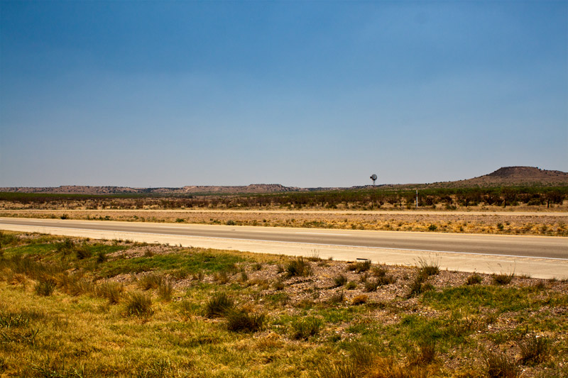
We passed a corral around an old-fashioned windmill.  We didn’t see any cattle around what I assume is a water station, but it did help break up the horizon.

Trees with green leaves were so rare that we were excited to see the trees around those buildings in the distance.  If you look closely you can see wind turbines on the horizon to the left of the trees.

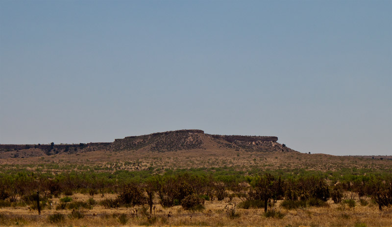
As we got closer to New Mexiico, we began to see some mesas on the horizon.  We also noticed a little more green in the landscape.

There were even more windmills now and then.

Fort Smith National Historic Site

July 7, 2011

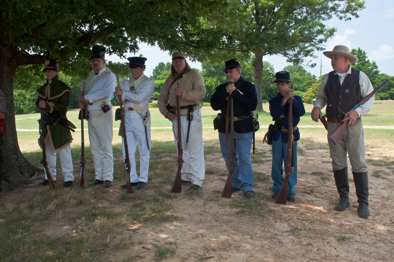
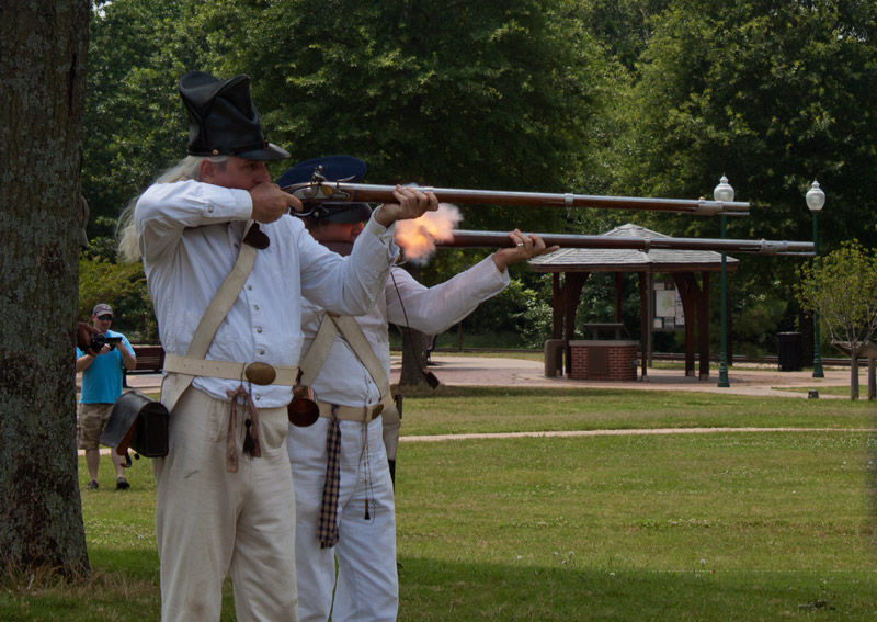
The uniforms of soldiers involved in Fort Smith's history. June 11, 2011.

One of the first places we visited on our recent trip west was Fort Smith National Historic Site in Arkansas.  During our visit we  were fortunate to be able to hear a presentation by a park ranger on the history of Fort Smith.  The ranger was supported by the re-enactors wearing the uniforms of soldiers during the different periods of the fort’s history.

Fort Smith was established in December, 1817, by a company of the U. S. Rifle Regiment (the soldier on the extreme left in the photo above).  The fort was established to maintain peace between the Osage and Cherokee Indians.  The original fort was abandoned in 1824.

In the 1830s Fort Smith became a supply depot for Indians and soldiers (next two soldiers in white) moving westward along “The Trail of Tears”.  In 1838 a new Fort Smith was constructed near the site of the first.   This was a masonry fort, but it was also used primarily as a supply depot.

Confederates (the soldier in butternut in the middle of the group above) took possession of Fort Smith when Arkansas seceded in April, 1861, but was recaptured by Union troops (next two soldiers) on September 1, 1863.

In 1872 the Federal Court for the Western District of Arkansas took over the fort.  The barracks were modified to serve as a courthouse and jail.  During this time the fort was a base for U. S. Marshals (the man on the extreme right).

The re-enactors described the uniforms they were wearing and gave a firing demonstration of their weapons.  The early muskets certainly made for an interesting show.

Firing 1830-era muskets. June 11, 2011.

This gives new meaning to 'the smoke of battle'.

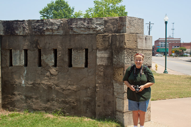
Betsy at a portion of the wall of the second fort. June 11, 2011.

We’re Home!

July 1, 2011

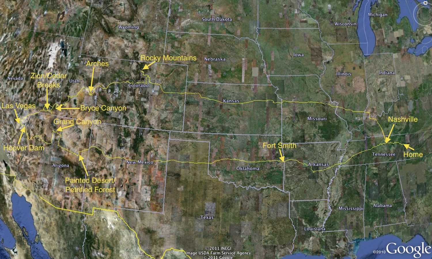
Betsy and I have returned from a wonderful 19-day trip out west.  The picture above, which can be enlarged by clicking on it, shows the highlights of our trip.  We drove 5,414 miles, passed through 14 states (counting Tennessee), visited nine National Parks, did some hiking and even saw some waterfalls.  Oh, yes, we also took many, many pictures.

I have to admit that Bryce Canyon was my favorite place — the hoodoos were absolutely fantastic.  But the Grand Canyon was every bit as grand as the name implies.

I think the high points for Betsy were the snow we encountered at both Cedar Breaks and Rocky Mountains National Park.  Six-foot drifts of snow in the June were a treat for my Beautiful Bride.  It almost made up for the snow we didn’t get here last winter.

Cades Cove: The Henry Whitehead Place

June 2, 2011

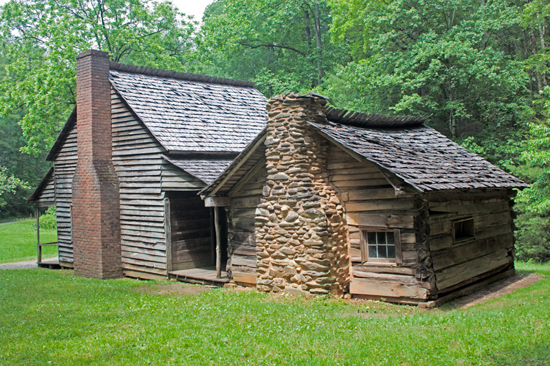
The Henry Whitehead Place in Cades Cove, Tennessee, showing the original cabin in the back. May 23, 2011.

A visit to Cades Cove can be scenic, interesting and educational all at the same time.  Getting off the beaten path can be fascinating.

Betsy and I came across the Henry Whitehead Place after leaving the Cade Cove Loop Road on our way to Parson Branch Road.  The Henry Whitehead Place is really two structures in one.  The original cabin (on the right in the picture above) was built by the brothers of Matilda Shields Gregory after her husband deserted her and her young son.  Because the brothers needed to get shelter for their sister in a hurry, the cabin they built is one of the roughest in Cades Cove.  The logs were rough-hewn with a felling axe and the stone chimney was made of rubble.

In 1898 Matilda married Henry Whitehead, a widower.  Henry built one of the nicest log homes in the cove.  The home had a brick chimney, which was unheard of at the time because bricks had to be made by hand.  The cabin itself was made of square-sawed logs finished inside to be smooth and attractive.  It was also warm by Cades Cove standards since the square log construction was naturally well insulated by walls approximately four inches thick with practically no space between the logs.

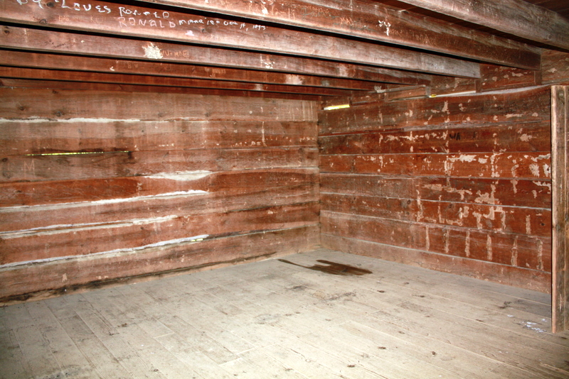
The interior of the Henry Whitehead Place, Cades Cove. May 23, 2011.

Betsy took this interior shot of the new cabin, showing the square-sawed logs forming the wall.

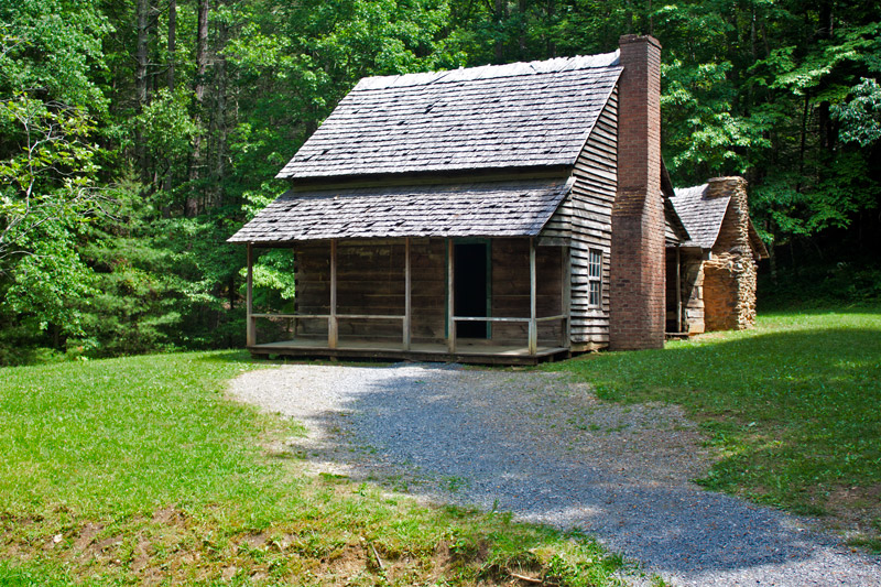
The Henry Whitehead Place, Cades Cove, Great Smoky Mountains, Tennessee. May 23, 2011.

The Henry and Matilda Whitehead place is the only square-sawed log home remaining in Cades Cove.  It is, in fact, the only one left in the entire Great Smoky Mountain National Park.

Down Memory Lane: The Blue Ridge Parkway

May 26, 2011

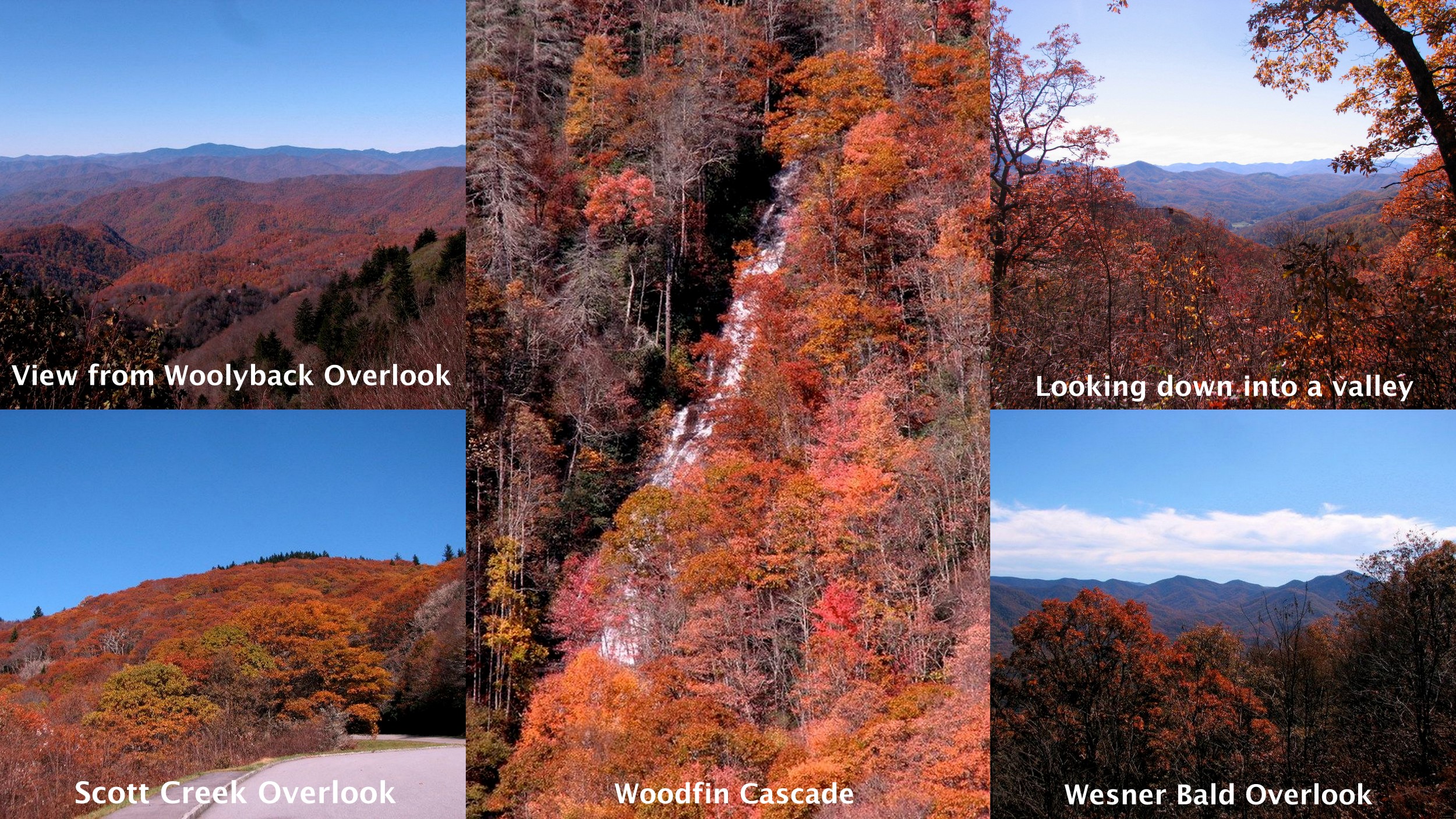
In October, 2009, Betsy and I took the scenic route home from Maggie Valley, North Carolina, by taking the Blue Ridge Parkway from Maggie Valley to its southern terminus in the Smokies.  Although we were a little late to see the best of the autumn colors, the mountains were still a glorious sight, which we thoroughly enjoyed, stopping at just about every overlook on our way.

To see larger versions of these pictures and others, click HERE.

Reflections in the Sand

May 19, 2011

The pier at Ocean Isle Beach, North Carolina. May 2, 2011.

One morning, as I was walking along the beach at Ocean Isle toward the pier, I was struck by the reflection of the pier in the wet sand.  It was nearing low tide, and there was plenty of wet sand to capture the reflections of the supports.

Fun With Our Geotracker

April 21, 2011

As many of you know, Betsy and I have a geotracker which allows us to determine the location of pictures that we take.  We’ve had it for a year, and use it whenever we take a trip.

Last week’s trip to Biltmore Estate was no exception.  We turned the geotracker on before we left home and were able to track our journey on Google Earth.
The map above, which can be enlarged by clicking on it, shows our journey from Fairfield Glade, Tennessee,  to Asheville, North Carolina.  As you can see we traveled almost the entire way on Interstate 40.  We timed our trip to miss rush hour in Knoxville, Tennessee, when traveling both ways.

This image shows the Biltmore Estate and the things we did once we got there.  This image, too, can be enlarged by clicking on it.

When we got to Biltmore we drove past the house and parked near the Conservatory.  It had been our intention to see the tulips first, but the azaleas were so pretty as we drove in that we decided to visit the Azalea Garden first.  So we walked over to the path to the Azalea Garden and walked through that garden down to the Bass Pond.  We then hiked around the west (left) side of the Bass Pond to the waterfall at the southern end.  We then walked back through the Azalea Garden to the Walled Garden where we enjoyed the tulips in bloom.

I’ve now given you a bird’s eye view of our trip to Biltmore, thanks to our geotracker.

On Top of the World

April 7, 2011

The view from Sunrise Point on Mount Nebo, Arkansas. April 1, 2011.

Betsy and I got up a couple of mornings to go to Sunrise Point on Mount Nebo to see the sunrise.  The first time it was so cloudy and foggy that we couldn’t even see the sun.

On our last morning it was nice and clear on top of the mountain, but when we got to Sunrise Point we were looking down on clouds and fog in the valley below.  It really wasn’t the view we were expecting, but I thought the predawn scene was pretty neat.  We felt on top of the world looking down at those clouds.

Down Memory Lane: Fort George

February 24, 2011

When Betsy and I visited Niagara Falls in 2002, we were able to take in sites other than the falls themselves.  One of the places we visited was Fort George National Historical Site near Niagara-on-the-Lake, Ontario.

Fort George served as headquarters for the Centre Division of the British Army during the War of 1812.  The fort was destroyed by American artillery fire and captured by the United States in May, 1813, during the Battle of Fort George.  The United States held the fort until December, 1813, when it was recaptured by the British.  After the war the fort was partially rebuilt, but was later abandoned in favor of more strategic installations at Fort Mississauga and Butler’s Barracks.

The original plans of the Royal Engineers guided the reconstruction of Fort George as a National Historic Site in the 1930’s.

The map above shows the location of Fort George on the United States-Canadian border.

To see larger versions of these pictures and others, click HERE.